Support the Timberjay by making a donation.

Packin’ a punch
REGIONAL— A major double-barreled snowstorm dumped as much as a foot of snow on the North Country this week, and considerably more along the North Shore of Lake Superior, providing the region …
This item is available in full to subscribers.
Attention subscribers
To continue reading, you will need to either log in to your subscriber account, or purchase a new subscription.
If you are a current print subscriber, you can set up a free website account and connect your subscription to it by clicking here.
If you are a digital subscriber with an active, online-only subscription then you already have an account here. Just reset your password if you've not yet logged in to your account on this new site.
Otherwise, click here to view your options for subscribing.
Please log in to continue |
Packin’ a punch

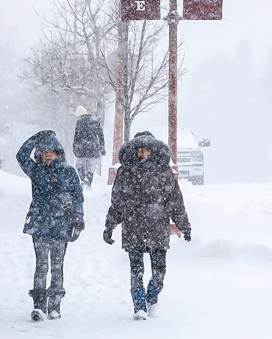


REGIONAL— A major double-barreled snowstorm dumped as much as a foot of snow on the North Country this week, and considerably more along the North Shore of Lake Superior, providing the region with a memorable taste of cold and snow after the mildest winter on record.
The powerful Colorado low that moved into the Upper Midwest provided an initial burst of snow starting late Sunday, which dropped anywhere from four to six inches across northern St. Louis and Lake counties. After a brief lull in the storm Monday evening, it wound up for round two on Tuesday, combining heavy snow, high winds, and temperatures in the teens to make for some of the toughest conditions of the entire winter season.
“It was a classic storm system,” said National Weather Service meteorologist Josh Sandstrom in Duluth. “And it had just enough cold air and the track was just right. It was also moving slowly which accounted for the extended periods of snowfall.”
The low moved up from the southwest and was sitting over the Minnesota-Iowa border on Monday, leaving the heaviest snow to the south of the North Country. On Tuesday, it moved up through Wisconsin, putting the Arrowhead in the bullseye for the heaviest snow and wind.
Reported snow totals around the area ranged from about seven inches in Cook to 14.3 inches at a reporting station a mile northwest of Ely, which was the highest reported to the National Weather Service in northern St. Louis County. Other reports included 11.6 inches at a station two miles southwest of Ely, 12- 14 inches in the Babbitt area, and 9.5 inches in Embarrass. The International Falls airport reported 11.6 inches. No reports from the Tower area were available as of press time.
Snow totals were even higher closer to Lake Superior, with some areas reporting close to two feet of snow from the storm.
While the storm packed a punch, the North Country was spared some of the worst effects a major storm can bring. While other parts of Minnesota and northwestern Wisconsin saw periods of rain and ice, the North Country remained on the dry and snowy side of the storm, helping to reduce the impacts often associated with large storms. While roads were snow-covered during the storm, they did not appear to be icy and that minimized traffic accidents in the region. As of Tuesday, the State Patrol was reporting no injury accidents in the region despite the snow.
Lake Country Power was listing no power outages in the region, thanks in large part to the lack of ice or wet, sticky snow, which can build up on powerlines and tree branches.
The snow brought some welcome relief from an intensifying drought in the region and should help boost lake and river levels, which have been remarkably low for the end of winter. Many streams in the North Country had been experiencing levels more typical of August than March in recent weeks. Water levels are usually buoyed this time of year by snowmelt, but the minimal snowfall this winter had already disappeared with no noticeable bump in water levels.
The U.S. Drought Monitor had recently upgraded the drought status in northeastern Minnesota from abnormally dry (the lowest level of drought) to moderate drought.
The snow has also offered a respite from the high fire danger experienced in the area in recent weeks. While a spring fire season is typical in the region in the wake of the snowmelt, this year’s melt came earlier than ever. And with low humidity and plenty of wind, conditions typical of late winter and early spring, the worsening drought had left area forests primed for fire.
This week’s snow should linger for a while, at least. High temperatures are expected to remain in the 30s through early next week, with lows ranging from the single digits to the upper teens. That’s just slightly below the area’s average high in the low 40s this time of year, with lows in the mid-teens.


