Support the Timberjay by making a donation.

Happy trails
Ely-to-Tower sections of Mesabi Trail taking shape
REGIONAL—After years of patient planning, the pieces are finally starting to fall into place for the Mesabi Trail between Tower and Ely. With rolling hills and pine forests, punctuated by two …
This item is available in full to subscribers.
Attention subscribers
To continue reading, you will need to either log in to your subscriber account, or purchase a new subscription.
If you are a current print subscriber, you can set up a free website account and connect your subscription to it by clicking here.
If you are a digital subscriber with an active, online-only subscription then you already have an account here. Just reset your password if you've not yet logged in to your account on this new site.
Otherwise, click here to view your options for subscribing.
Please log in to continue |
Happy trails
Ely-to-Tower sections of Mesabi Trail taking shape
REGIONAL—After years of patient planning, the pieces are finally starting to fall into place for the Mesabi Trail between Tower and Ely. With rolling hills and pine forests, punctuated by two exceptional state parks, the roughly 25 miles of paved trail that will eventually connect the two communities is expected to be the premier stretch of the 146-mile-long Mesabi Trail.
As with much of the trail’s development, the section between Tower and Ely is being built in bits and pieces, and two of those pieces were finally paved in just the past couple of weeks.
One of them, a roughly two-mile stretch beginning in Soudan, has provided a key link between a longstanding section of the trail that runs between Tower and Soudan, and a relatively new stretch of trail running through the Lake Vermilion State Park. Contractors finished paving the connection earlier this month. The trail runs through mature pine and birch and includes an exciting series of S-curves down a steep slope. It’s safe for bikes, but roller bladers will want to use caution going downhill.
The new connection provides a continuous section of the paved bike trail from Tower to the cell tower located just off Hwy. 169, a distance of about seven miles.
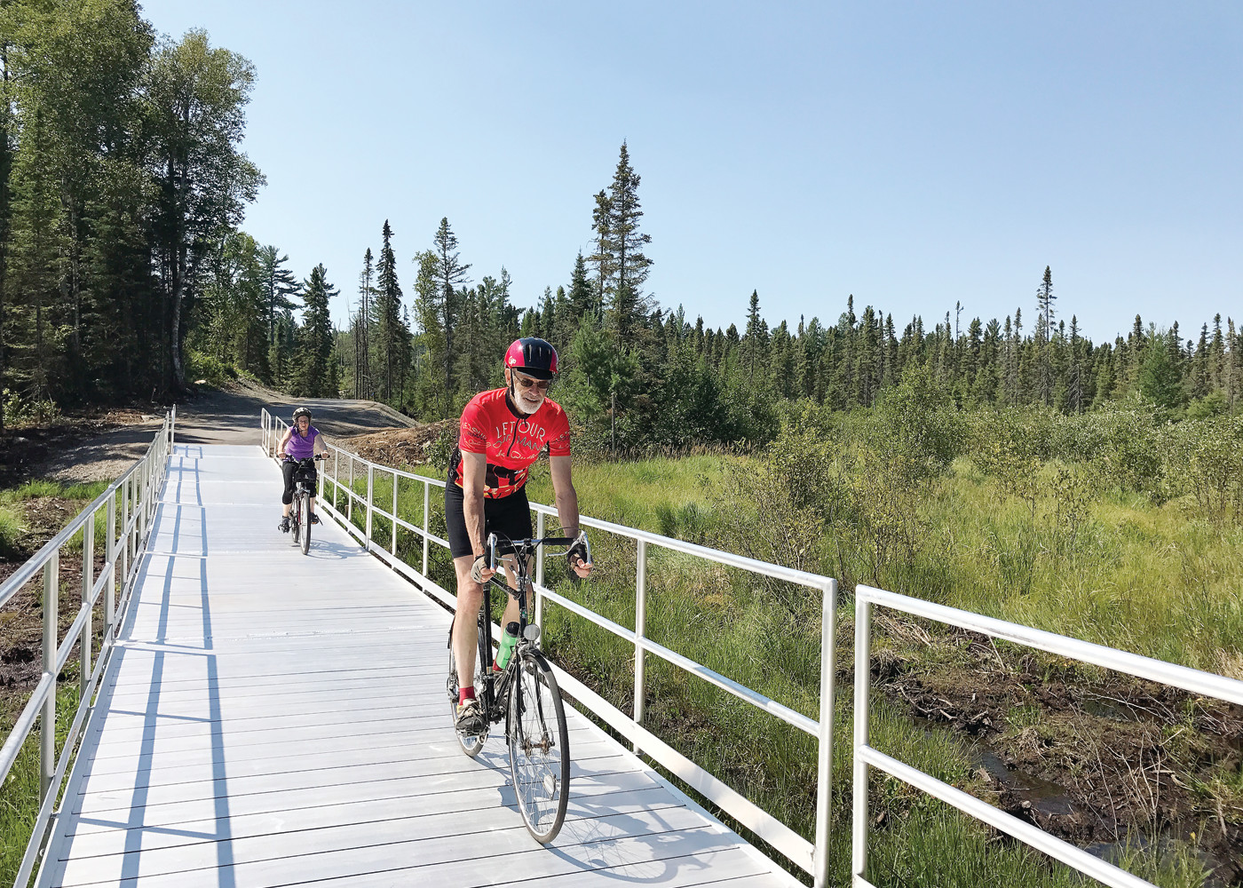
Perhaps the most exciting new trail segment is the just-completed stretch that runs from the Eagles Nest Town Hall almost six miles to the east, towards Ely. Unlike much of the Mesabi Trail, which follows rail grades and old highways, the new Eagles Nest section winds through hilly terrain, around rock outcrops, past small, remote lakes, and even passing over a floating bridge across a wetland. It currently terminates along the abandoned railroad grade that runs between Tower and Ely, and the trail will continue along the grade at least as far as County Rd. 88, just west of Ely. The rail authority has funding to pave a portion of the rail grade, from County Rd. 88 to the railroad underpass on Hwy. 169, and Mesabi Trail director Bob Manzoline said he hopes to begin work on that segment next year. Plans for the trail will be on the agenda at the Morse Town Board meeting, set for Sept. 12, said Manzoline.
The authority does not have current funding for the section from the underpass to the terminus of the Eagles Nest section, but Manzoline said they will be working to obtain the grant dollars as soon as possible.
Tying the new Eagles Nest portion together with the Tower-Soudan segment could happen as early as next year, said Manzoline. The St. Louis and Lake County Regional Rail Authority, which oversees the Mesabi Trail, just received $750,000 to help with the effort. The funds will allow the rail authority to recondition several miles of Hwy. 169 which are being abandoned as part of the highway realignment project in Eagles Nest Township. Trail officials have not yet determined how they’ll recondition the highway, but hope to begin the work next year. Manzoline said they’ve discussed removing one lane of blacktop and revegetating it, or just leaving the entire road corridor intact to save money. While that option would leave a very wide corridor compared to most sections of the trail, it wouldn’t be the first time that the trail utilized abandoned highways, said Manzoline.
The old highway segment would advance the trail as far as the intersection with Trygg Road, which would leave about a mile-and-a-half gap to connect with the trail segment starting at the Eagles Nest Town Hall. Manzoline said he’s currently working with township officials to map a course around some of the Eagles Nest lakes. “We’ll hopefully start building on that stretch next year,” he said.
If so, that would create a continuous trail roughly two-thirds of the way from Tower to Ely.
The final remaining gap in the trail, said Manzoline, is the stretch from County Rd. 88 into the city of Ely. Manzoline said the trail is facing a number of landowner concerns in that area, which may force the trail to locate within the existing highway right-of-way for the roughly mile-and-a-half stretch. “It’s not the best, but it may be the only option,” said Manzoline.
So when will you be able to bike on the complete trail between Tower and Ely? “If we’re lucky, by 2020,” said Manzoline. “But 2021 is more likely.”


