Support the Timberjay by making a donation.

Fighting fire with fire
Forest Service works to reduce wildfires
ELY – The U.S. Forest Service used fire to fight fire late last week as part of a fuels reduction prescribed burn along the north arm of Burntside Lake.
Fire managers had ideal weather for the …
This item is available in full to subscribers.
Attention subscribers
To continue reading, you will need to either log in to your subscriber account, or purchase a new subscription.
If you are a current print subscriber, you can set up a free website account and connect your subscription to it by clicking here.
If you are a digital subscriber with an active, online-only subscription then you already have an account here. Just reset your password if you've not yet logged in to your account on this new site.
Otherwise, click here to view your options for subscribing.
Please log in to continue |
Fighting fire with fire
Forest Service works to reduce wildfires
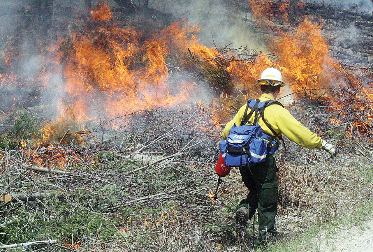
ELY – The U.S. Forest Service used fire to fight fire late last week as part of a fuels reduction prescribed burn along the north arm of Burntside Lake.
Fire managers had ideal weather for the project, said USFS public information officer Becca Manlove.
“As part of the ongoing Burntside Area Fuels Reduction project, two small units totaling 31 acres were targeted for this prescribed burn,” she said.
The two units, totaling approximately 31 acres, were set on fire northwest of Ely in the Superior National Forest along and near the North Arm Road (SLC 644), north of Burntside Lake.
One unit covered about 12 acres and the other unit covered about 19 acres, Manlove said.
Ignition of the fires was done by hand. Firefighters used drip canisters which were filled with a combination of gasoline and diesel fuel. Fire bombs were also used during the action.
Zone Fire Management Officer Timo Rova was the burn boss for this exercise.
“Weather conditions are very good and if everything goes good we should be able to burn both of the areas,” he said.
Trees and brush along the North Arm Road were cut and thinned last November in anticipation of the fuel reductions project, Rova explained. He said the first two burn projects of the year were small in comparison to other reduction projects.
“We want the fires to burn hot enough and in the right direction to help reduce the possibility of future fires in the area,” Rova said. “We also want the smoke from the fires to drift away from developed areas and structures.”
Mop up and monitoring continued for several days after the burn which was initiated during the afternoon of May 23.
“These two units will see a succession of burn treatments,” Manlove said. “This first burn under relatively moist conditions is designed to burn the finer, flashier fuels—mostly debris about as thick as a pencil and smaller. At a later time, another burn will be done to consume larger fuels to open the units for vegetation regeneration.”
Two information stations were established on either end of the burns by Manlove and Kris Reichenbach and were marked by Fire Information signs. Residents and other interested people stopped by the stations to pick up maps and other information.
Factsheets and maps were uploaded to the Superior National Forest website for additional alerts and information about current conditions. Go to:www.fs.usda.gov/superior Scroll down to Fire Info/Prescribed Fire/Current Plans/Burntside.
For more information, call 218-343-3026.


