Support the Timberjay by making a donation.

A place in time
Thoughts on a long, wet slog through the swamp
Am I crazy? That was the thought that kept running through my mind recently as I carefully picked my way through tangled alder and floating muskeg on just another of what I like to call my “blank …
This item is available in full to subscribers.
Attention subscribers
To continue reading, you will need to either log in to your subscriber account, or purchase a new subscription.
If you are a current print subscriber, you can set up a free website account and connect your subscription to it by clicking here.
If you are a digital subscriber with an active, online-only subscription then you already have an account here. Just reset your password if you've not yet logged in to your account on this new site.
Otherwise, click here to view your options for subscribing.
Please log in to continue |
A place in time
Thoughts on a long, wet slog through the swamp


Am I crazy? That was the thought that kept running through my mind recently as I carefully picked my way through tangled alder and floating muskeg on just another of what I like to call my “blank spot on the map” treks.
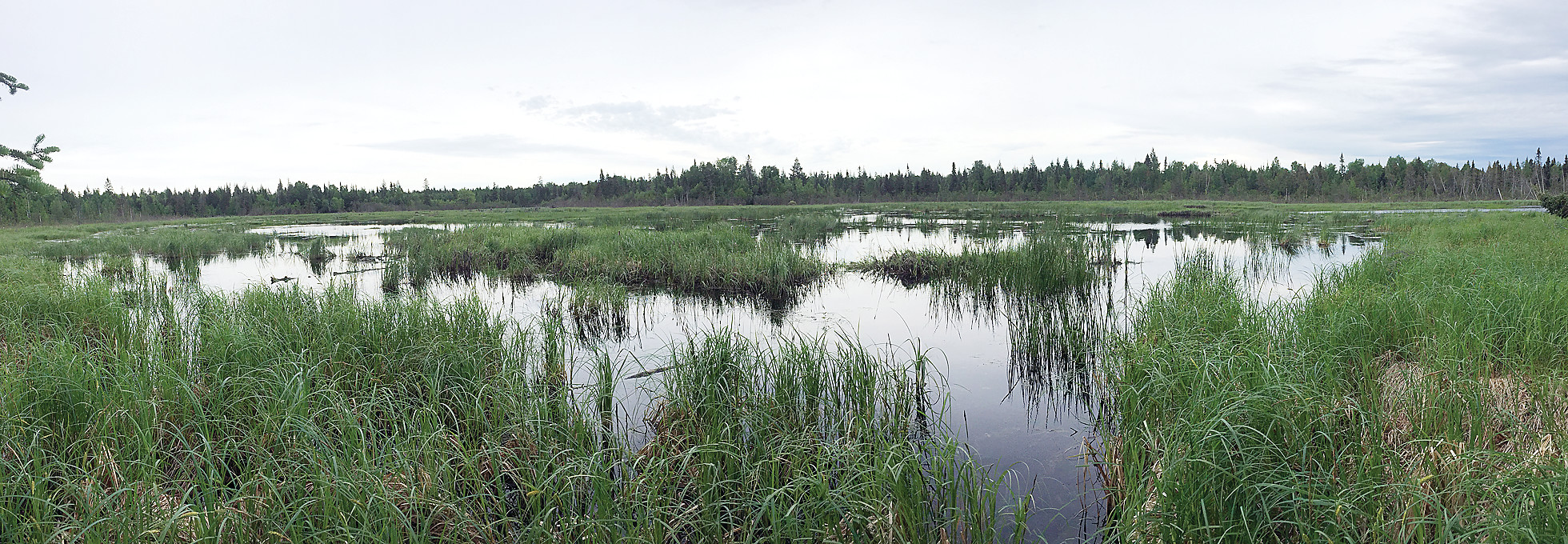
As a general destination, I was right at home, working my way into yet another remote corner of the Lost Lake Swamp. It was late June, and my destination was an enormous beaver pond that sits along the headwaters of the Little Fork River, in roughly the northwest corner of the swamp.
You won’t find it on a map. The U.S. Geological Survey’s Lost Lake quadrangle provides the most detailed look, on paper, at this remote area, but the best it can do is signify thousands of acres with the little “swamp” icon that the USGS has used for many years on its maps. And that can’t possibly describe in any useful sense the complexity of the wetland environment in the Lost Lake Swamp. On this most recent trek, I found the swamp overflowing from the abundant June rains, like a huge overland river of water flowing slowly to the northwest. It was like walking through a version of the Everglades, minus the alligators. For more than two miles, almost every step challenged the limits of my rubber boots, although I somehow avoided filling them until my return trip, hastened by impending rain.
I understand that, in June, I should be using my recreational time to do the normal things, like fishing. Instead, there I was, on a cool, muggy day, decked out in camouflage and bug dope, carrying lunch and my camera gear into terrain that would very closely approximate most peoples’ version of hell on Earth.
Am I crazy? It’s a recurring question on such journeys.
I blame my predilection for extreme wandering mostly on Google Earth which has given digital form to those blanks spots on the map, with satellite images that show in detail landscapes that, on USGS maps, used to be consigned to those generic swamp icons or simply to that cheery, unmarked green, interrupted only by the occasional topo line, that fills in the blank spots on higher ground.
It’s the blank spots that catch my eye. Lately, I’ve been eyeing beaver ponds. Zero in on a satellite image close enough in the North Country, and you discover a landscape that’s littered with the telltale signatures of beaver activity, and they provide a reasonable destination for someone who is regularly in need of an excuse to explore.
On Google Earth, I had recently spotted one of the biggest beaver ponds I’ve ever seen, and I was headed out to take a firsthand look.
I had hoped to take advantage of the remains of an old road for part of my journey, that had been closed nearly 20 years ago when County Road 115 was built, conveniently connecting both ends of Lake Vermilion by road for the first time. But while the route of the old road was clearly visible on Google Earth, there was nothing even approximating a passable road once I had arrived on the scene. Everything was underwater, and the former roadbed was choked with alder. I ended up paralleling the road through terrain that alternated from tamarack to ash, to willow, to open, sedge-filled fens. Needless to say, it was slow going. I eventually connected with the Arrowhead snowmobile trail, and followed it for a time. The trail was more open, but it was also a flowing river on this day, and, once again, I had to skirt the edges. The trail did finally lead to a small upland island, and the solid ground offered a brief respite before I had to turn south and plunge back into a particularly nasty thicket of alder and ash on the last leg of my trek.
Navigating in such terrain is incredibly difficult. Even with a compass in hand at all times, it’s tricky to follow a bearing, since you can’t look ahead for landmarks. In an alder thicket, you’re lucky to see twenty feet ahead. I had brought my iPhone, and I was glad for its GPS app, which provided a valuable correction on my errant bearings more than once. I prefer to rely on a map and compass, but this was one of those places, where the limits of the old technology were readily apparent.
I eventually arrived at another tiny upland island, that formed part of the north shore of the beaver pond and, with great difficulty, picked my way through one of the worst tangles of downed trees and dense brush that I’ve ever encountered, until the panorama of the pond was before me.
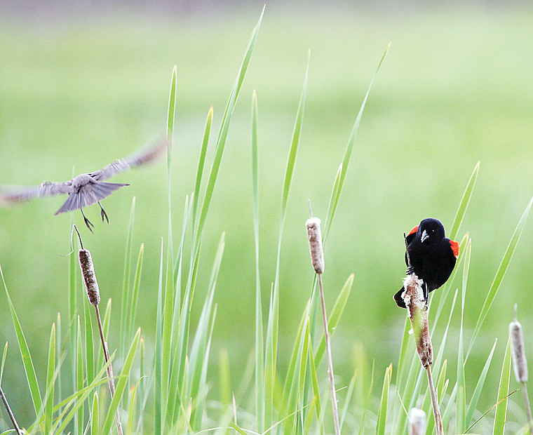
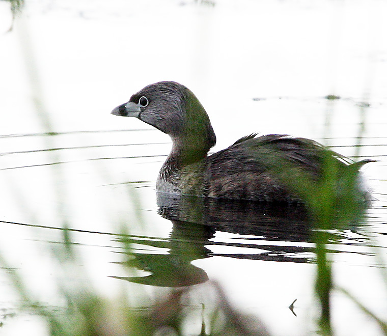
I had hoped to photograph ducks and other waterfowl on the pond. They were there, to be sure, along with herons, cormorants, and pied-billed grebes, whose loud, strange calls set an appropriate mood. But the pond was so large, that most were far away. I sat on the shore for almost an hour, mostly just watching, taking a few shots of redwings and one of the grebes that happened to pass my way.
I wondered how long it had been since human eyes had looked out across this place. The USGS map did indicate the little pinprick of an island I was sitting on, so at least one intrepid surveyor had once passed by this way. That may, very well, have been the last time, however. I saw no sign of human activity. Just wilderness, left to its own devices.
Perhaps that’s what I enjoy most about my journeys to the blank spots. Even here in the North Country, we’re surrounded by the signs of the human world, with our roads and towns, and fields, not to mention a forest that was entirely reshaped by humans. Beyond the roads, far off into the swamps or the deepest woods, those signs recede and eventually disappear, and that’s where we still meet nature as it is. As it’s always been.


